new Klamath class 4 run OPEN: Kikacéki Canyon
Pronounced K’-EE-kah-ts’EH-kee, this name is the Shasta tribe's place name for the 300 foot deep canyon, replacing the white man's name "Wards". Kikacéki or K’íka·c’é·ki Canyon has a stout gradient of 78 feet per mile for 2.7 miles, from Grizzly Hill to Fall Creek. These access points on native lands opened to the public on August 1, 2025.
We paddlers are invited to visit from dawn to dusk within designated areas. We happily respect tribal lands in gratitude for their willingness to share this incredible canyon. The State of California transferred ownership of the the canyon and its access points to the Shasta Indian Nation in 2024. Earlier this year a group of indigenous teenagers became the first group to paddle the whole 310 miles of river. The tribes are overjoyed that their river is free again.

Indigenous teens float through river that was reservoir not long ago.
The Canyon run is the hardest part of the whole river. It has fairly continuous whitewater with seven class 4 rapids in a gorge of columnar basalt. For 106 years this canyon was dewatered by hydropower dams, and nobody went there. Now there's water all summer, and the shuttle is short. Paddlers traveling on I-5 only need to drive 20 miles away from the interstate to hit the run, and commercial rafting outfits will take customers down there as well.

Screenshot from Google maps terrain view.
Copco 1 was the dam built at the top of the canyon, flooding the valley upstream for 106 years. One month after the dam removal salmon were swimming upstream past its location. Only 500 yards downstream was Copco 2, a dam that diverted the entire river into pipes and tunnels for 1.75 miles to the powerhouse. Only at very high flows did water enter the river channel, so brush and trees grew in there. The canyon was claimed as private property by Copco, and later Pacificorp, keeping everyone out with fences, gates, and security officers. Check out OPB's before and after scenes of the dams and reservoirs.
In 2002 and 2020 a few people got to run the canyon during dam relicensing and dam removal studies. This video shot from a raft during the 2020 boating flow study about about 800 CFS shows the woody growth in the whitewater, which was cut out in 2023. The median flow in the summer is expected to be less than 1200 CFS.
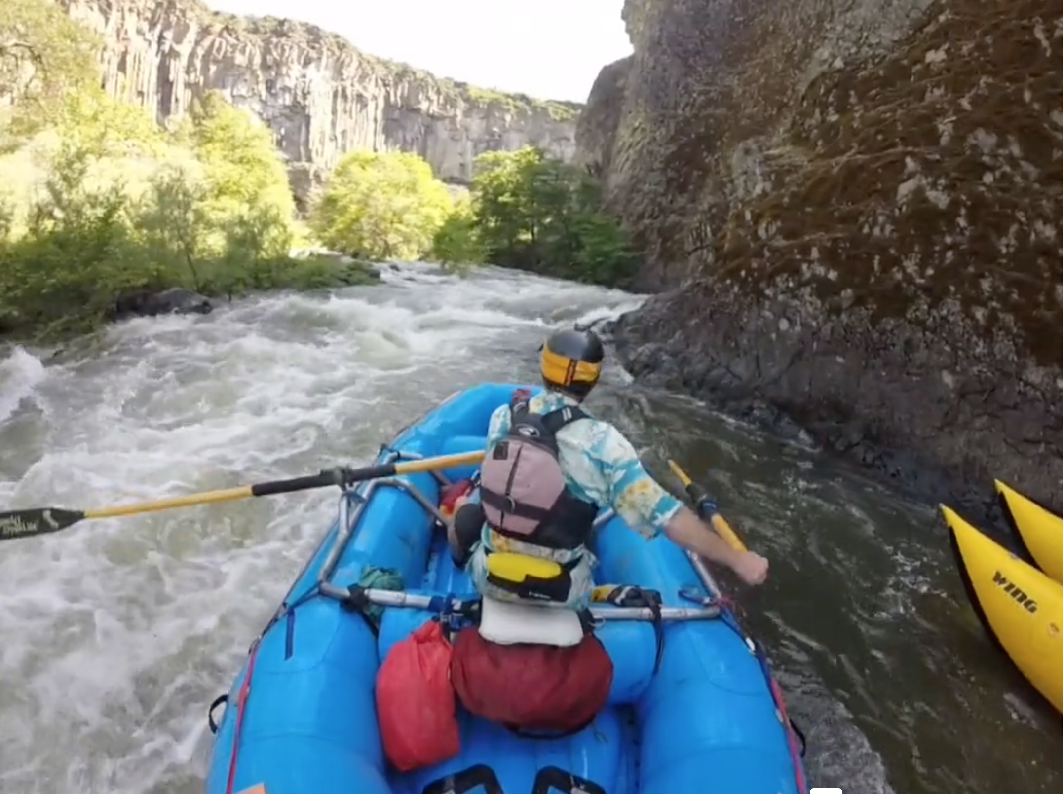
Screenshot from the 2020 video linked above.
It sounds like the best overnight run would be to continue downstream from the canyon on the Iron Gate run.
The Klamath has been known for a long time, but it's a whole new destination now. I look forward to exploring this short class 4 section as well as doing longer self-supported runs.