No permit? No problem!
Try these North Idaho paddling suggestions
By Bill Brock
Before Valentine’s Day, everyone who applies for an Idaho river permit is a winner. For at least two weeks, you’re happily daydreaming about that new line through Velvet Falls or a redemption run through Ladle.
The majority of those dreams wither and die on 14 Feb, when lottery results are announced. A tiny flicker of hope lingers for a week or two because maybe – just maybe – someone drew a permit and you are on the margins of an invite.
Hope. It’s a powerful force, but it’s gone by the time March rolls around. If you haven’t gotten a Middle Fork or a Selway invite by then, well, you probably aren’t gonna paddle those rivers this year.
But that doesn’t mean you can’t paddle in North Idaho.
As a Class IV paddler who lives a few miles west of NRS World Headquarters in Moscow, Idaho, here is my list of favorite local creeks and rivers. The snowpack is low this year, so hit the following suggestions sooner, rather than later.
Top of the list is the Lochsa River. It’s 150 miles on the dot from my house to the standard put-in at Fish Creek, which makes for a looong day if I have to be home that night. Given this, my pals and I typically spend a night at the Wilderness Gateway campground – which allows for another run the following day before the long drive home.
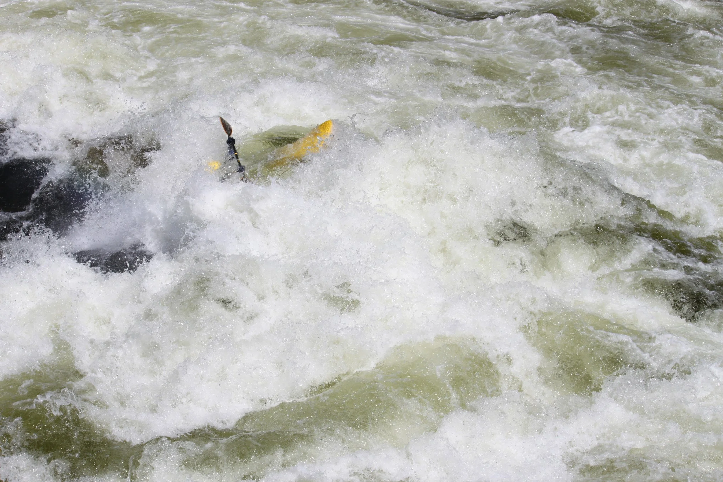
Bill running Lochsa Falls on a Memorial Day a few years ago.
The Lochsa is legendary for its big water bedlam over the Memorial Day weekend, but we paddle it into late June -- when the water is low and the weather is warm. The standard run is from Fish Creek to Split Creek, a distance of nine miles. This is where you’ll find such cheerfully named rapids as Grim Reaper, Bloody Mary and, of course, Lochsa Falls.
Highway 12 runs right next to the river, so it’s pretty easy to thumb the shuttle if you only have one vehicle. If nine miles on the Lochsa isn’t enough, you can always launch upstream of Fish Creek.
Farther north and a touch west is the St. Joe drainage, which offers plenty of variety. The easiest way to get to the upper river is from St. Regis, Montana, which is on Interstate-90, west of Missoula. When the road is clear of snow (and it won’t take long this year), roll south from St. Regis over Gold Pass. You’ll hit the Joe about a mile upstream of Conrad Crossing, which is the put-in for the Tumbledown Falls stretch.
Further downstream is the old railroad town of Avery, where the North Fork of the Joe joins the mainstem. With the possible exception of No Sweat rapid, the North Fork is an easy Class III run. If you’re coming from the west, aim for the town of St. Maries and drive up the St. Joe River.
Downstream of Avery, several creeks of varying intensity tumble into the St. Joe. Slate Creek, which is the most difficult water I paddle anymore, comes in from the north; bring your A Game if you’re heading to Slate Creek. My favorite run is Marble Creek, which drains into the Joe from the south. The run is five miles of hootin’ and hollerin’ that one of my pals describes as “… like an unstable amusement park ride that was assembled by carnies on meth.” Another notable creek in the St. Joe drainage is Big Creek, which pours in from the north; shuttle logistics for Big Creek are challenging.
Closest to home is the ephemeral, yet committing Potlatch Canyon. The put-in is little more than 20 miles east of NRS in Moscow, right next to the Little Boulder Campground. Potlatch Canyon starts off slow, so there’s plenty of time to warm up, but it’s stays pretty busy after the crux drop at Coleman Falls. Potlatch Canyon is a gem, but it’s hard to catch at a comfortable level.
Roughly 145 miles south of Moscow by road is the Little Salmon River, which joins the Main Salmon at Riggins. For the most part, the Little Salmon is a busy little Class III stream, punctuated by occasional drops of greater consequence. If you’re into bigger water on a bigger river, there’s always the Main Salmon downstream of Riggins.
(Though it’s nowhere near North Idaho, the Murtaugh stretch of the Snake River deserves mention as an outstanding 14-mile stretch filled with big drops and great play spots. Located just upstream of Twin Falls, roughly halfway between Boise and Pocatello, the Murtaugh – which is dam controlled – wears many hats. At flows of 8,000 cfs and higher, it has a big water feel evocative of the Grand Canyon. In the 1,500-8,000 cfs range, it is a playboater’s delight. And below 1,500, it becomes tight and technical; at low water, many a paddler has emerged from Duckblind rapid with a black eye or two.)
There, that’s my list of fun day trips in the middle third of North Idaho.
Your mileage may vary.